Download Maps
Johnson Lake Trip – Part 1 of 2
Johnson Lake Trip – Part 2 of 2
Directions
Johnson Lake is an approximate 13.5 miles trek into the Golden Trout Wilderness from Horseshoe Meadow. The trail makes great gains and losses in elevation creating a good test for backpackers endurance and readiness for longer trips. The trip treks over Cottonwood Pass, touches the Pacific Crest Trail, makes its way through Big Whitney Meadow, and climbs up to Rocky Lakes Basin. You’ll have to cross-country for a mile to after arriving at Rocky Lakes Basin to arrive at Johnson Lake.
The trail begins at Horseshoe Meadow nearly 10,000 feet in elevation. Hike west 0.3 miles to the first trail junction. Continue going west along the northern portion of Horseshoe Meadow for another 3.4 miles. This is a nice “warm up” stretch before the trail starts gaining significant elevation. Once across two stream crossings, the trail begins the steep climb up to Cottonwood Pass (11,160 feet). Depending on when your trip is there may be horses or pack trains going up and down the trail. Make sure to step off the trial on the downhill side to let them pass.
Once at the top and you have enjoyed the views at Cottonwood Pass, take the trail heading downhill towards Big Whitney Meadow. The beginning portion can be steep. You’ll be trekking down along Stokes Stringer Creek, which headwaters include Chicken Spring Lake. Once down in Stokes Stringer Meadow the trail is not as steep while it continues to go downhill.
Big Whitney Meadow has an “island” in the middle of it. On the east side of the island a small unmaintained trail continues north and up to Siberian Pass. Continue west along the trail for another 0.7 miles. The trail will join up with another main trail junction. Again, continue west as the trail going north also treks up to Siberian Pass.
Shortly after the last trail junction another one begins going west and up the hillside. Take this trail as it will begin climbing in elevation and going west of Big Whitney Meadow for approximately 2.6 miles. If you make a mistake, the trail will bend south along the western edge of Big Whitney Meadow and treks down Golden Trout Creek.
After hiking up and down hill towards Barigan Stringer Creek, another trail junction occurs near the creek. Take a right (north) following the creek uphill towards Rocky Basin Lakes. The trail mostly follows the creek uphill for another 1.7 miles. You’ll come to a creek crossing and continue on until a trail junction. Stay to the left for another 2.6 miles into Rocky Basin Lakes. The trail will end at the most western lake.
Here is where you will need to cross-country to Johnson Lake. Follow the southern boundary of the lake west. Trek in a southwest direction once you are at the western most part of the lake. You will ultimately cross-country 1 mile through a small pass to Johnson Lake. Use a compass, if needed, and refer to the map to stay on track.

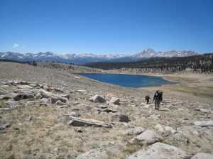
Photo by MK JS RS
Optional: If you are feeling adventurous or want to see as many lakes as you can on this trip, then this optional trek may be what you are looking for. Once at the small pass between Rocky Lakes Basin and Johnson Lake, head in a northwest direction for another 1.6 miles. You’ll arrive at Florence Lake. The lake is located within the National Park, so no camp fires above 10,000 feet. Check with the Park Service for additional restrictions/requirements if you decided to go this route.


Great site, modest correction- the lake NW of the pass is Funston Lake, not Florence