Tony recently went out backpacking for several days. The trip only touched a portion of the GTW, but the intel and insights on alternative ways into the Inyo’s side of the wilderness could be helpful to some. For example, with Horseshoe Meadow Road still closed, there are other ways to get there. For example, one could use the PCT at Kennedy Meadows. Are there others? What are the conditions? Well read on and see what Tony has to say.
This is a trip report for a nine day hiking trip starting near Kennedy Meadows, on the Kern Plateau. Our trip just–really, only just–touched the Golden Trout Wilderness, and that was only briefly, but here goes, anyway. We started on Tuesday, June 6th, and hiked out on Wednesday, June 14th, 2023.
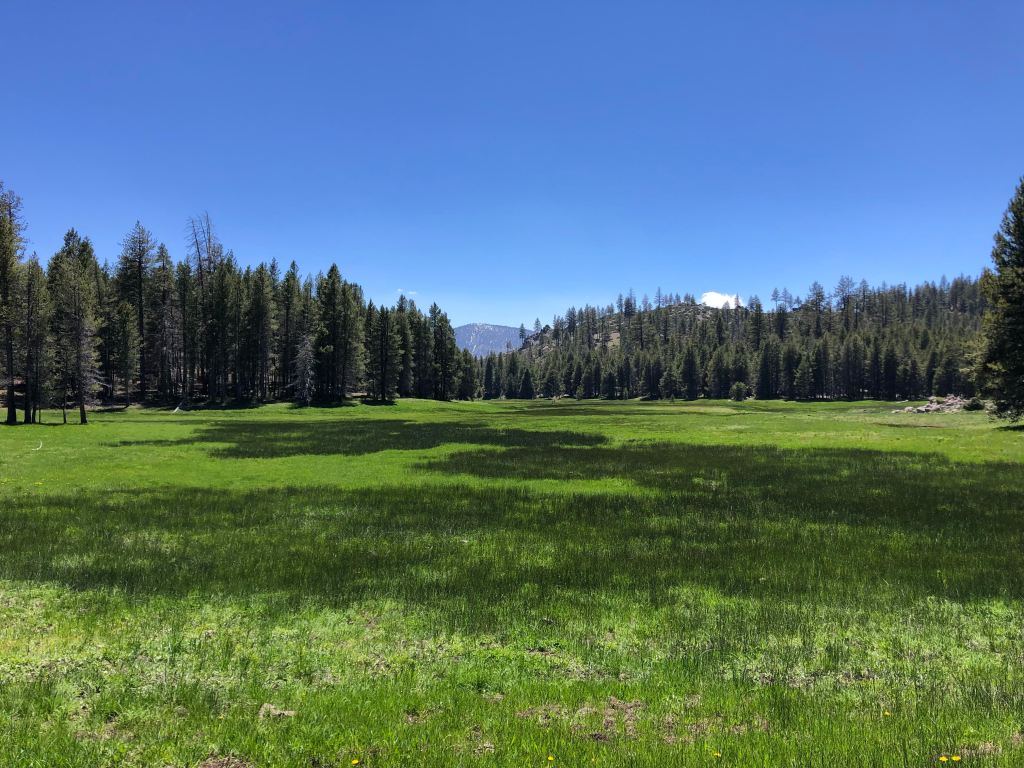
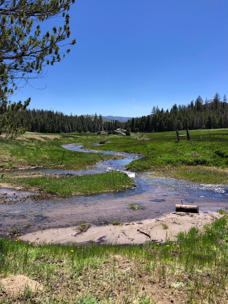
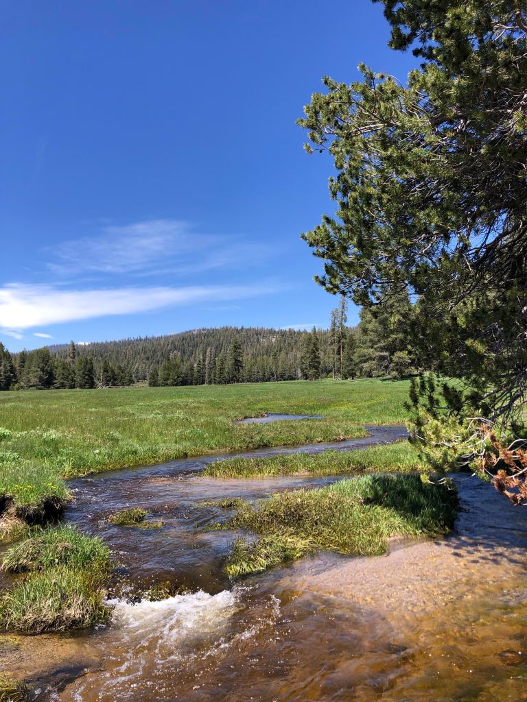
My hiking buddy, Rich, and I parked at the Hooker Meadows trailhead, which is basically just a small turnaround at the end of a dirt road near the Fish Creek USFS campground. We hiked to Albanita Meadows, and had them to ourselves. The trail was easy to follow at first, but then we lost it for awhile in a meadow. Then the trail was OK to Hooker Meadows, at 8,400 feet. However, the trail along much of Hooker was very indistinct, and then it got worse getting to Albanita Meadow. Essentially, since you only find snippets of trail here and there, and because you hike directly up a string of wet meadows, we squelched our way toward Albanita through the creek and the mud. It was wet going! We had a nice camp spot that night–and it snowed, but it was just a light dusting.
We next headed down to Monache Meadows via the old Broder Meadow trail, which we picked up across from Agua Bonita spring, which is in the middle of Albanita Meadow. There is a newer motorcycle trail west of the old trail, but we wanted to take the footpath instead. The footpath shows on the Tom Harrison GTW map, but not on the Tom Harrison South Sierra Wilderness map. I would estimate that we could find the trail between 5-10% of the time. It, too, has almost completely disappeared.
From the north end of the Broder Meadow trail, we headed northwest via a motorcycle trail, a short stretch of the Monache Meadow jeep road, and a foot trail to Bull Meadow and McConnell Meadow. We could only find the foot trail about 5% of the time, even though it appears on the Harrison maps and the Sequoia NF recreation map. The cartographer must think it pretty funny to represent that these trails still exist, when they appear to be abandoned. Certainly, there hasn’t been any trail maintenance done in decades, apparently.
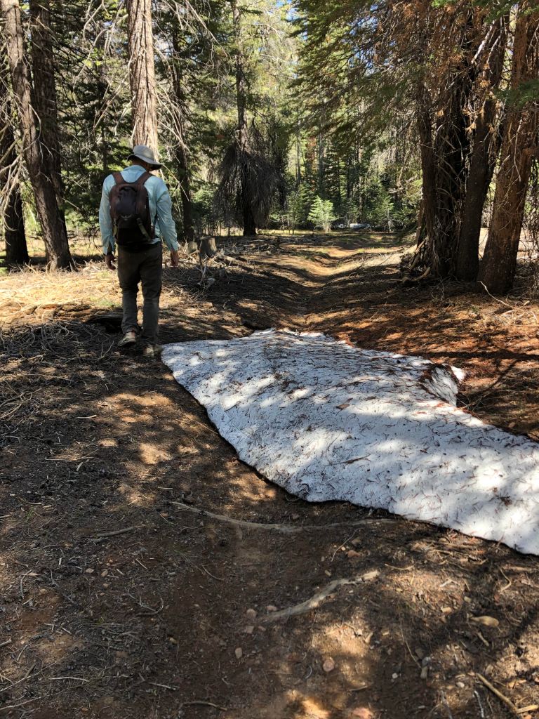
The next morning, we squelched our way through to Little Dry Meadow. There is really no trail whatsoever, and there were a ton of fallen trees and snow mounds blocking the way. Little Dry Meadow should have been called “Little Sopping Wet Meadow”! We then squelched our way through the mud to the north end of the meadow, through an area with even more downed trees, but eventually found the trail going to Big Dry Meadow, which was our destination. However, once we entered the GTW the trail disappeared, and fallen trees and much snow filled the canyon almost entirely. I think that even without snow and fallen trees, the trail still would have been extremely difficult or impossible to follow, at least for right now.
We debated turning around, but instead hiked up Kingfisher Ridge to get above the snow and fallen trees, and we followed the top of the ridge northwards to intersect the “trail” coming from Monache Meadows. The current “trail,” which again is in exceedingly poor shape, was once the jeep road to Casa Vieja Meadow, prior to the establishment of the GTW. Same story–lots of snow, mud, and fallen trees, and a very indistinct trail for the most part. The going finally got good near Kingfisher Stringer, and from there we followed the jeep road into Monache Meadows.
The South Fork Kern River was just raging! The water is so high that it eroded half the width of the jeep road in one place directly east of Monache Mountain. We saw one side-by-side utility vehicle in the distance, which I surmised belongs to the ranger at the Guard Station. We later heard one motorcycle, but we assumed it belonged to the resident of one of the private inholdings in Monache Meadows. That’s because we saw that the jeep road into Monache was impassable due to some fallen trees, so the two vehicles we saw/heard must have been kept in the Meadow over the winter. They could not have been driven in this year, given the impassable jeep road and the terribly muddy (and still closed) OHV trails into Monache from points south.
We eventually returned to Albanita Meadows via Beck Meadow and the Lost Meadow Trail. The Lost Meadow Trail appears on some maps but not others; for example, it does not appear on the 15″ topographic map but does show up on the Harrison GTW map. It, too, is extremely indistinct, until one gets relatively close to Albanita Meadows. There is no trail any longer through Lost Meadows itself, although we did see an old “Lost Meadows” sign at the south end of the meadow, where the trail finally appeared.
My hiking buddy and I originally had hoped to hike out of Horseshoe Meadows, but the road from Lone Pine was not yet open; hence, the hike in via Hooker Meadows was Plan B…and achievable. We had a very nice trip. We only saw a few people and the scenery, just emerging into Spring/Summer, was lovely. However, it rained almost every day, the old trails are essentially non-existent and have received zero trail maintenance seemingly in decades (as far as we can tell), the trail maps are out of date, and there was a lot of mud. A LOT of mud. All the creeks were very high. We enjoyed having a campfire most nights.
The Hooker Meadow trail is a potential way of accessing the Golden Trout Wilderness from the south, when the Horseshoe Meadows road is still closed by snow. However, taking the PCT into Monache Meadows from Kennedy Meadows is likely a better idea, or perhaps even hiking into the Wilderness from the Blackrock trailhead to Casa Vieja Meadow. The reality is that the Hooker Meadow trail, and the network of other old, historic trails around Monache Meadows, make for really tough going. If you want an easy to follow trail, go elsewhere. If, however, you want a lot of solitude and enjoy challenging route-finding, and relish forests and meadows rather than alpine scenery, then do consider the Hooker Meadow trail.
See you down the trail!
Thanks Tony for the information! For those that were thinking of alternative ways into the wilderness, I hope this was insightful on what to expect should you venture out on the same or similar path Tony did. If you have trail reports to share, please continue to send them in. They are very much appreciated!